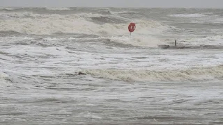
The National Meteorological Service of Mexico declared a state of alert on Wednesday in anticipation of Tropical Storm “Alberto,” which is expected to “make landfall” on Thursday.
The General Coordinator of the Meteorological Authority, Alejandra Méndez Girón, said in a press conference that the storm will be the first of its kind during the 2024 season in the Atlantic Ocean, and it is expected to make landfall at dawn on Thursday in the state of Tamaulipas, in the northeast of the country.
The official explained that the storm began in the Gulf of Mexico, 195 kilometers northwest of Frontera and Tabasco and 235 kilometers to the northwest.
The tropical storm is expected to intensify with wind speeds of 63 to 118 kilometers per hour, with its center located about 295 kilometers east of the Panuco River, north of Veracruz.
Tropical Storm Alberto formed on Wednesday over the southwestern Gulf of Mexico, about 300 kilometers east of Tampico, Mexico, and about 480 kilometers southeast of Brownsville, Texas.
According to the National Hurricane Center in Miami, maximum wind speeds reached 65 kilometers per hour.
Tropical storms are characterized by sustained winds ranging from 62 to 117 km/h, and if winds exceed that average, the storm turns into a hurricane.
Tropical storm warnings were issued from the Texas coast from the San Luis Pass south to the mouth of the Rio Grande River and from the northeastern coast of Mexico south of the mouth of the Rio Grande to Tecolutla.
The National Hurricane Center said the storm was expected to gain some slight strength on Wednesday before making landfall on Thursday.
“Rapid weakening is expected once the center moves inland, and Alberto is likely to dissipate over Mexico” on Thursday, the center said.
Maximum rainfall of 51 centimeters is possible across the high terrain in the Mexican states of Coahuila, Nuevo Leon and Tamaulipas, and the center said flash floods were likely, with the possibility of mudslides in some areas.
The US Weather Service said the main danger to the southern Texas coast is flooding caused by heavy rainfall.
The Meteorological Service said on Wednesday that there was a "high possibility" of flash floods, as well as tornadoes and vertical wind vortexes in the south Texas coast.
The National Oceanic and Atmospheric Administration expects that the hurricane season, which began on June 1 and continues until November 30, will witness a much larger number of hurricanes than average, between 17 and 25 named storms, while expectations indicate the occurrence of up to 13 hurricanes and 4 major hurricanes. .


It is alarming!
ReplyDeleteInformative
ReplyDelete